Farahan County
Farahan County
Persian: شهرستان فراهان | |
|---|---|
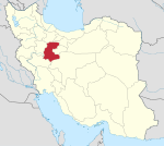
 Location of Farahan County in Markazi province (center, pink) | |
 Location of Markazi province in Iran | |
| Coordinates: 34°38′N 49°39′E / 34.633°N 49.650°E[1] | |
| Country | |
| Province | Markazi |
| Capital | Farmahin |
| Districts | Central, Khenejin |
| Population (2016)[2] | |
| • Total | 28,994 |
| Time zone | UTC+3:30 (IRST) |
Farahan County (Persian: شهرستان فراهان)[a] is in Markazi province, Iran. Its capital is the city of Farmahin.[3]
History[edit]
After the 2006 National Census, Khenejin Rural District was separated from Komijan County and the former Farahan District was separated from Tafresh County in the establishment of Farahan County, which was divided into two districts of two rural districts each, with the city of Farmahin as its capital.[3]
Demographics[edit]
Language[edit]
The majority of the county’s population are Persians who speak the Persian language.[4]
Population[edit]
The census in 2011 counted 30,042 people in 9,535 households.[5] At the 2016 National Census, the county's population was 28,994 in 9,744 households.[2]
After the census, the village of Talkh Ab was elevated to the status of a city.[6]
Administrative divisions[edit]
Farahan County's population history and administrative structure over two consecutive censuses are shown in the following table.
| Administrative Divisions | 2011[5] | 2016[2] |
|---|---|---|
| Central District | 17,118 | 16,237 |
| Farmahin RD | 10,158 | 7,845 |
| Feshk RD | 2,663 | 2,636 |
| Farmahin (city) | 4,297 | 5,756 |
| Khenejin District | 12,924 | 12,757 |
| Khenejin RD | 5,897 | 2,838 |
| Talkh Ab RD | 7,027 | 6,684 |
| Khenejin (city) | 3,235 | |
| Talkh Ab (city)[b] | ||
| Total | 30,042 | 28,994 |
| RD = Rural District | ||
See also[edit]
![]() Media related to Farahan County at Wikimedia Commons
Media related to Farahan County at Wikimedia Commons
Notes[edit]
References[edit]
- ^ OpenStreetMap contributors (30 August 2023). "Farahan County" (Map). OpenStreetMap. Retrieved 30 August 2023.
- ^ a b c "Census of the Islamic Republic of Iran, 1395 (2016)". AMAR (in Persian). The Statistical Center of Iran. p. 00. Archived from the original (Excel) on 17 October 2020. Retrieved 19 December 2022.
- ^ a b Rahimi, Mohammad Reza (11 November 1388). "Approval letter of reforms and divisional changes in Markazi province". SOLH (in Persian). Ministry of Interior, Board of Ministers. Archived from the original on 19 January 2024. Retrieved 19 January 2024.
- ^ https://www.icmr.ir/en/markazi-province/county/farahan
- ^ a b "Census of the Islamic Republic of Iran, 1390 (2011)". Syracuse University (in Persian). The Statistical Center of Iran. p. 00. Archived from the original (Excel) on 19 January 2023. Retrieved 19 December 2022.
- ^ a b Rouhani, Hojjat al-Islam (14 November 2017). "With the approval of the Board of Ministers, Talkh Ab village of Farahan County was recognized as Talkh Ab city". Young Journalists Club (in Persian). Ministry of Interior, Board of Ministers. Archived from the original on 30 August 2023. Retrieved 30 August 2023.

